



Overview
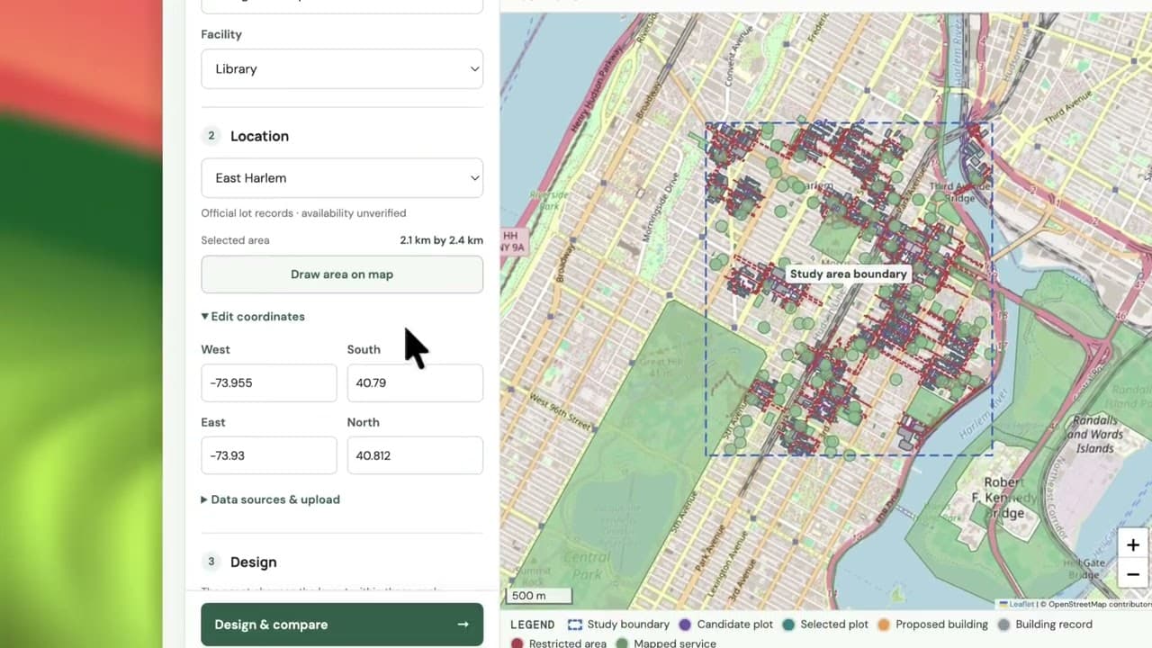
GeoScope helps planners and community teams explore where a clinic, library, school or community centre could fit and whether it would improve access. Users select a neighborhood and set building and open-space goals. An agent plans the analysis, generates Python, and tests layouts against supplied parcels, buildings and roads. Results show checked alternatives, existing nearby facilities, a 3D preview, and estimated walking access before and after the proposal. Vultr Compute Instances host the FastAPI controller and a separate worker connected through a private VPC. All agent LLM calls use Vultr Serverless Inference. Generated code executes inside disposable gVisor containers with no outbound network, read-only inputs and resource limits. A fresh sandbox recomputes submitted designs before displaying results, with downloadable code, metrics and execution traces. The demos cover San Francisco and East Harlem. SF candidate plots are simulated; geometric checks do not establish land ownership or construction approval.
Note: the demo URL is substituted with the GitHub repository link.
Tech stack
No comments yet
Be the first to comment on this project.
sentinel
Full-Stack Self-Healing DevOps & Security Copilot The Concept: An AI operations engineer that doesn't just suggest code fixes—it monitors cloud infra, detects uptime/security drops, automatically provisions fixes, and generates audit reports for enterprise compliance.
Agency Compiler
Agentic creative project compiler. Most creatives, agencies and designers dont know how to use ai, none the less agents. We created a platform that allows a creative agency or studio owner to instantly spin up agents based on the project ask, resources and scale.
ProofRun
ProofRun helps developers answer a critical question before shipping: will this update break behavior users rely on? An AI agent inspects two Git revisions, designs targeted experiments, and proposes repairs. An independent Docker-based verifier runs those experiments against both versions, preserves the original tests, and checks whether the repair actually works. Developers receive an update, skip, or postpone recommendation with recorded evidence and a reviewable patch. In a live synthetic…